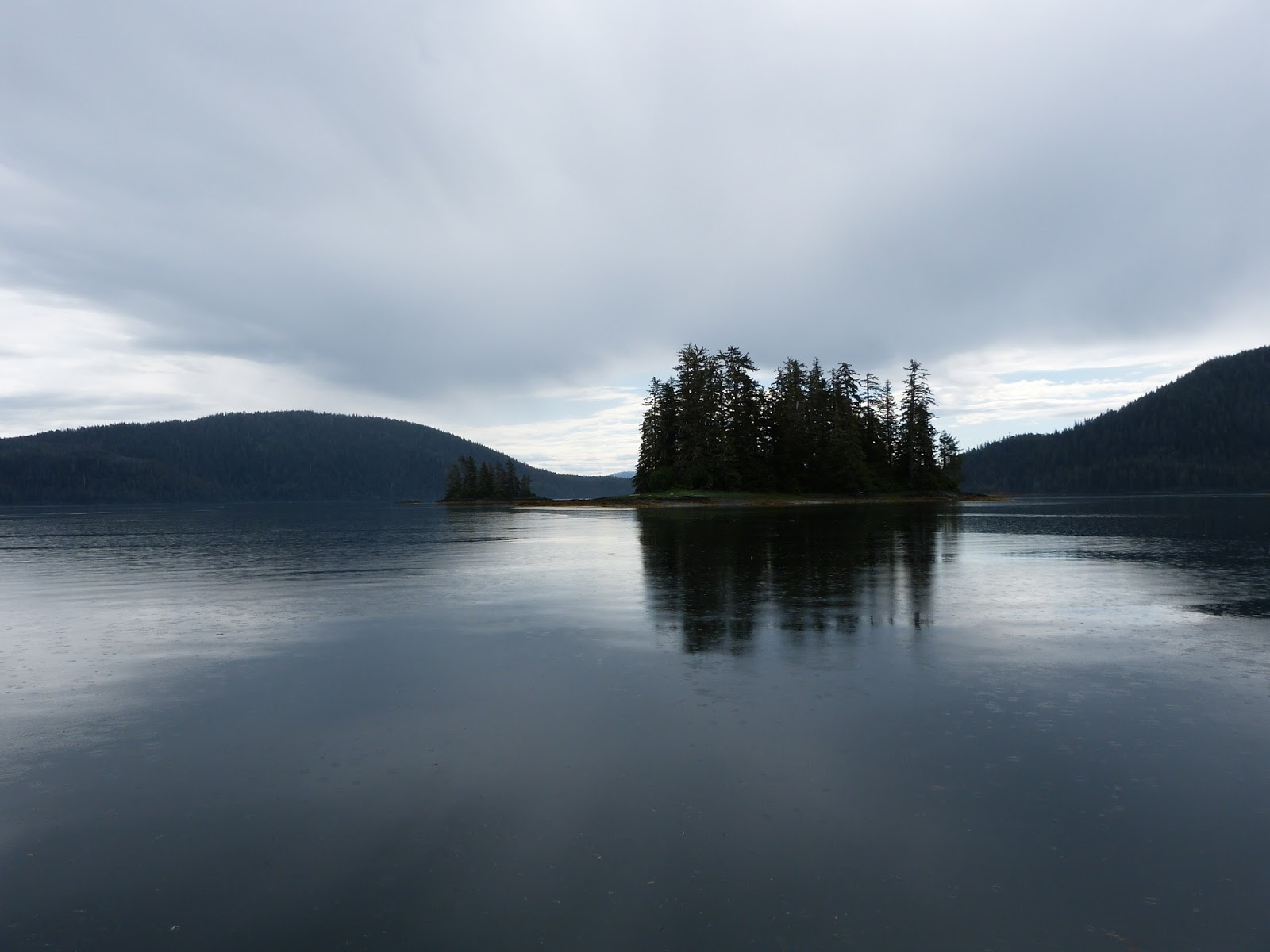
Tuesday, July 28, 2015

June 29  OD 1000 and on to Foggy Bay for the night.  Nice day on the water.  Pulled into Foggy Bay about 4pm to find a lovely anchorage.
Foggy Bay
                                                                        Foggy Bay Sunset
June 30  AU 0430.  Bound for Prince Rupert.  Winds are predicted for later in the day so we decided on an early start.   By 0700 we were in 5-6  foot seas with NO wind.  Go figure.  Gary called Canadian Customs....since we really weren't going to clear until Rupert....to tell them that we were not going to be able to make Rupert and were going into Wales Harbor.  They said...."do what you need to do and call us when you make Rupert".  So we slid into Wales at 0830 and called it a day.  We should have given it a try later as there were no winds that developed but oh, well!  We had a good dinghy ride.
                                                                Magic at Wales Harbor
                                                               A cold lunch plate
July 1 0400 AU  A weather window exists so off we go.  Winds are NW at 5-15 with 3 foot seas predicted.  At 0600 the water was flat and no wind developed!  Flat water and blue skies all the way to Rupert where we cleared customs at 0900 and headed down the big ditch....Grenville Channel...the Inside Passage.  We slid into Kelp Bay at 1300 but found no protection from a north wind which was predicted so we headed south to Kumealon Island Cove which is a very nice anchorage.  We got a very slight wake from 1 BC ferry but not bad.  The winds died and we were greeted by 3 kayakers from the middle of nowhere.  They had put in at Bella Bella and were heading to Rupert.  One was from Lopez Island, one from Maine and one from DC.  They had met at Colorado College.  None had ever done any kayaking before fut they were learning.
July 2  Slept in until 0730.  AU at 1230 to catch the tide/currents in Grenville. Channel.  A couple of weeks ago Gary decided to try to give Diesel a haircut and he still looks quite pitiful.
                                                             You get what you pay for!
We made Evening Point (where the current changes in the channel...at that point it splits and ebbs north , floods south and ebbs south and floods north....something to be aware of.....North of Evening Point it was blowing 15-20 kts in the Ditch w/ 4-5 seas but they were following so we had a nice QUICK ride.  At Evening Point it laid down to a 1-2 ft chop and we were making 9 kts.  lickety split.  We hit Lowe Inlet at 1600.  We had a fair amount of wind inside but we held just fine in 80' of water.
                                                                Lowe Inlet Entrance
                                                            Verney Falls in Lowe Inlet
July 3, Friday AU 0730  Grenville is flat.  Gales are predicted over the entire coast from Sun through Tues from So Hecate Strait to Pine Island.  We are inland to protected water!  We made Kiskosh Inlet at 1240 which is one of our favorite places.  With the warm weather this year, the usually snow capped peaks were bare but still beautiful and the crab were again plentiful.
                                                                    Kiskosh Inlet
                                                              Kiskosh Inlet
July 4 0830  AU  BIG crab in our pots!!!
Douglas Channel is rough and the gale is still threatening.  There are no good anchorages for > 50 miles going south.  Butedate would be iffy at best....if there is still a dock there so we decided that Hartley Bay would be a good destination.  They have great water, and a free dock.  It is a nice little Indian community and since the fishermen were out we had our choice of dock space.  It was a good housekeeping day.  Got the floors done!  It was hot by 1600 when the breeze died off.
July5  0700 OD  The water was bumpy until we hit McKay Reach and then smoothed out.  Thank goodness we didn't opt for Butedale as it appears to be in shambles, more so than usual!.  I read that someone now bought it last year with high hopes but so far nothing.  No one was there and if the dock was usable you could have fooled me. But 1400 we are pretty far south and the air smells smokey and looks foggy.  We were going to go up Kynoch but the Coast Guard reports a fire up Roscoe Inlet so we opted for Bottleneck Cove.  HOT with no breeze.  83 inside the boat!  73 inside by 10pm.  Not a good night for a sound sleep.
July 6  AU 0640  Heading for the ocean and some breeze and away from smoke.  Note to self: never spray OFF on nail polish!!  My freshly done toes turned gummy! Yuck.   We made Oliver Cove on Reid Passage at 1130 and called it quits.  There was a nice breeze and it was cool.  We had a lazy, easy day.
July 7  0900 AU  Just a short little day to Mouat Bay which is nothing more than a pretty rock pile.  Protected water, off Seaforth Channel so it had a nice little breeze and cool temps.
July8  0845  Dense FOG as we are trying to pick our way out through the rocks.  But Gary did it.  The fog lifted at we headed up Spiller Channel.  We hit Neekas Cove at 12 noon where it was once again beastly hot.  We should have stayed nearer the channel.
                                                     Neekas Cove off Spiller Channel

July9  0920  AU  Looking for a cool place to go!  We made Wigam Cove at 1000.  A nice breeze coming in off Seaforth Channel.  Whew. Very nice.  A Pacific Trawler from Anacortes pulled in behind us.  They launched their dinghy and went exploring.  Pretty soon we heard a radio call to us from their dinghy.  They had lost their motor in the channel and were drifting toward rocks and wondered if Gary could use our dinghy to come out and give them a tow.  Nice people!  who rewarded Magic' Towing Service with a nice Happy Hour!
July 10  AU 0745.  We hit the grocery in Bella Bella at 0915.  They have improved that store immensely!  The produce was lovely.  But no water on the dock due to drought!  Left Bella Bella for Shearwater at 1030.  Got the laundry done and spent a rocky night due to the water taxis screaming into the dock until 0100!!  The Pacific Trawler folks and their other boating friends were there also.
July 11  0830  Left the dock via water taxi to go to Bella Bella to meet our friend Susan who will be joining us for a week.  The water taxi driver tried to call me a cab.  Cab driver still asleep!  But he suggested the grocery store might call me a cab and they open at 9.  Cab driver, Darren, still asleep! I told them I had no allegiance to Darren; was there another person to call?  They called Jerry who came and drove me out to the airport which was culture shock in itself.  The airport looked like a house trailer, no security and the terminal has a cat that wanders around and slinks up against your legs while you await your arriving guest.  Then Susan was in for culture shock when she arrived.  First the terminal, then a taxi ride through the Indian village, then a water taxi then finally our boat!
1100  OF and bound for Ocean Falls.  Got there about 1600 and there was no room on the dock!  So we proceeded south to Codville Lagoon.  We had dinner underway and arrived at 1930.  Long, disappointing first day but we are flexible.
July12  Happy 35th Anniversary to us!
                                                                    July 12, 1980
 AU at 0700.  Pulled a nice load of prawns and moved on south on a flat Fisher Channel to Hakai Pass where we went to the beach and spent the night in Pruth Bay.
                                                                Friends since 1972
Hakai Beach  One of the few on this part of the coast with white sand.

                                                   First time on the beach.  He loved it.

July 13. On to Fly Basin in Smith Sound for a bit of crabbing and a dinghy ride.
                                                          Sunrise leaving Fly Basin


July 14 0500  AU  West Sea Otter has 4kts.  We're outta here and rounded Cape Caution. at 0730.  Flat water with a low swell made for a wonderful day.  Gary caught a nice coho for dinner.  At 1100 the fog rolled in and we made for Blunden Harbor for the night where we ran into a couple from Shelter Bay aboard Island Spriit.  They came over for Happy Hour and we had a most enjoyable visit.
               Old native village at Blunden Harbor in about 1900..photo taken at Alert Bay museum

July 14  0900  AU  Crab omelets for breakfast.  Were heading for Jennis Bay but got word they were not open.  Then decided to go to Sullivan Bay but then we heard a winds forecast.  We HAD to be in Port McNeil on Saturday to get Susan on her plane so we opted for Alert Bay for two days and then on to Port McNeil to drop Susan at a much more modern looking airport.  I think she had a nice time....we enjoyed having her and she seemed in awe of the scenery.  She caught a salmon off Lizard Point on Malcolm but the photo is on her camera!

July 19  OD at 0520.  Winds predicted but they sound better heading south.  By 1130 the seas were about 5 ft in Johnstone Strait at Kelsey Bay and they seemed quite confused.  We headed into Helmken Island for the night where we ran into another boat from Shelter Bay!
                                                  North anchorage at Helmken Island.
July 20  AU 0530  Calm predicted.  20 kts at Blind Channel...some calm!  but it got better at Chatham Point so we pulled into Cameleon Bay at 0915 and had a day of rest!
                                                             Sunset at Cameleon Bay

July 21  AU 0530  It was a gusty night but 0500 winds at Chatham Point at 12.  By 1230 we had crossed the north end of the Strait of Georgia and were tucked into the Copeland Islands.  We spent a night with 8 other boats...5 of which were stern tied.  It was a constant parade of boats up Malaspina Strait....just outside our anchorage....toward Desolation Sound.

July 22 Au  0630  Heading for Buccaneer Bay.  Malaspina was rough 4+ ft which was not predicted.  The winds died off but afternoon and we had calm water by 2000.

July 23  Au 0520.  The strait was flat and clear.
                                            Mary Island Lighthouse, Strait of Georgia
1100 anchor down in False Creek, Vancouver  Took the dinghy to the public market for some flowers and olives and Saint Agur cheese, baguettes, tomatoes and cherries.  Had dinner with friends on Grenville Island and dinghied back to the boat for the night.  It was quite gusty the next morning and there are no hiding places for about 40 miles so we just spent a lazy day in the harbor enjoying the market purchases.
July 25  AU 0520  Winds 9kts at Sand Head.  Homeward Bound!  From 0600- 0800 we had a most unpleasant 3' beam sea but then it flattened out just past Sand Head and it was smooth cruising.  We decided to head to the San Juans for one last prawning adventure.  At 1300 we dropped our prawn pots near Jones Island and went over to McConnell Island to drop the hook for a couple of hours to let the pots soak.  At 1630 we were rewarded with a nice pull!! By 1730 we had the hook down in Swift Bay for our last night out.
July 26  AU 0720  Last leg.  Good water.  Light wind.  Under the Rainbow Bridge at 1100!
Shelter Bay dock at 1130!  HOME!!  13 weeks, one day.  Our longest cruise yet.  It was wonderful and we were both ready to be home for awhile.  Thanks for joining us along the way.  We hope it has been enjoyable and informative.  Until next time.............
Magic out.


Monday, July 27, 2015

Today is July 27 and I am having to back track to finish this blog because of lack of internet connections, commitments we had and some other things too.  So that said, the good news is that I did keep a daily journal with multiple posts throughout the day about things we saw and did and things that were of interest to us or to other boaters.  So here goes............
Remember that AU = Anchor Up and OD = off the dock.......for brevity.

June 14   OD  0700.  The weather gods have been exceptionally good to us this year.  Sumner Strait is flat!  We were bound Port Beauclerc on the west side of Sumner Strait.  G. Vancouver weathered a mega storm there in 1793...I just love being a part of the history of these remote places.  We are again having holding tank issues sooooo since the water is flat and the winds predicted are minimal we will put in a long day and head to Red Bay to anchor tonight.
                                                                  Exit from Red Bay

June 15  AU 0500.  Sumner still flat.  Long day ahead.  Made K'town at 1615 and passed Katie B's ship leaving KTN as we were arriving.  Small world.


June 17  Gary spent all day the 16th on the tank. I hope the danged thing is fixed. It is becoming a source of frustration.  OUr problem is that we can't pump overboard, which is what most people do up here in the wilds.  For you city folks there are VERY FEW pump out stations in remote BC and AK.  They are fewer than internet connections.  This is not good because in these remote areas we have to be self reliant.  Keep in mind that Gary is extremely mechanically talented and when he can't fix it there is a real problem.  He was starting to get a bit cranky!
So this AM we were OD at 0700 to the fuel dock to find that they opened at 0800.
Here is a good place for a point about AU and OD times like 0430, 0500, etc.  In the summers in BC and Alaska the water is normally calmer early in the morning before the afternoon warming starts to kick of the winds and hence the waves.  As the winds and waves increase the ride gets less comfortable.  Early departures are hard but worth it in the long run.  And then you usually finish your cruising day by 1 or 2 in the afternoon.  Of course, we are going to bed early too!
Okay, we got our fuel and got away to find Clarence Strait and Dixon Entrance flat at 1230.

                                            The best kind of water on Dixon Entrance.

We are heading around the south end of Prince of Wales Island (from now on POW) for a few days.
At 1630 we cruised into "Double Scotch Byte" (we named it)

Sort of open to the ocean but behind a couple of small islets too.  Quite lovely and the weather is calm and will remain...so what the hey?  The holding tank works, the dinghy motor works, the water is flat....Life is good.

June 18 0700  AU  It came up clean but we didn't budge all night.  Very nice settled weather anchorage.  Dixon is still flat...not even a low swell this morning.  At 1100 we cruised into Elbow Bay on Long Island in Cordova Bay SW POW.  Good anchorage.  Nothing special but good protection if needed.

Another calm water totem at Elbow. 
June 19 AU 0845.  The dog has been pill less for  days now.  Everything is improving.  Portage Bay at 1130 to find one sailboat and one bear.  
June 20  AU 0630  Leaving will be require a bit of concentration.  Sulzer Narrows ( the entrance into Portage Bay) is shallow at best and the tide will be some lower than when we came in.  We made it through on a 5.2' tide with 7.5 ' under the boat.  0830 we cruised into Deer Bay with about 10 pounds of prawns that we pulled up on our way in.  1215  AU and onto Eek Bay
PRAWNS in a Dick's bucket!
June 21  0730  AU   Hydaburg at 1000. 
Totem in cemetery at Hydaburg


 No cell phone service from the boat and that was the whole reason we went there..certainly not for a retail experience....Father's Day...dang!  Sorry Chester.  We moved onto the McFarland Islands.  There is one unmarked and uncharted rock, mid channel about 10' deep on a 0 tide.  Gary named this place "Single Malt, Drop the Hook. Let'r Rip Bay".


June 22 Au 0545  Over the rock on a 9.8' tide with 18 feet under the boat.  Gorgeous spot;  unknown/unpublished by Douglas.  We made our way into Craig about 1130 and had some pizza in town, picked up a few grocery items and called Gary's dad a day late.
June 23  OD  0800  Picked up some fuel.  The water is flat but strong winds are predicted in the next few days.  We are heading for a secure anchorage.  At 1300 we made our way into Cyrus Cove.  Beautiful, bombproof and a bear on the beach.  What more could you ask?

                                                        Bears make the anchorage!


                                               We found this guy standing along the way.
Back in the land of otters.
June 24  AU  /Gary fished a bit for salmon but had no luck.  We were in the midst of a lot of whales.
 At 1430 we made our way into "Whales and Otters and Bears!  Oh, my! Bay"
June 25  Winds are predicted.  We are heading south.  We were in Cordova Bay between 1300 and 1500 hours.  It is semi open water.  We were taking 3-4 foot head seas and the boat did great!!  Bumpy but not uncomfortable...and I am a woos!
                                                                 Cordova Bay
1600 Dunbar Cove.  Stormy!!  35 kts at Sukkwan Island...just about 10 miles away.  15-20 where we are on the hook.  Tucked in nice and cozy.

June 26  AU 0740  Winds calm inside.  20kts outside and blowing 50 north at Eldred Rock..  We are still OK.  Diesel is now 3 weeks without pill.  He did great even yesterday in 4' seas.  Peeing and pooping on the grass mat without fail. At 1330 we got back inside to Portage Bay.  Prawn and crab pots are out. salmon in fridge.  Good day with flat water.  This is the year of repeat ports and anchorages.
June 27  AU  0700 Good crab and prawns. Cooked!   Good water for cruising  2 days to Ktn...Ooops!  out of propane.  Thank God for the cooked prawns and crab in the fridge!  Dixon Entrance flat again....living right.  1610 into Gardner Bay on the SE side of POW.  We shared the bay with about a dozen fishing vessels who left to fish at about 0200.
June 28.. AU  0540  Clarence Strait flat.  Into Ktn at 1130 for fuel, propane, Safeway, laundry.
                                                      Green Curried Thai Prawns for dinner


Tuesday, June 16, 2015

On June 12, we got off the dock at 0915....lazy people!  got some fuel and headed out with the intention of going to Anita Bay but we wanted to put out prawn pots and the commercial guys were dragging for prawns so we changed our destination to Roosevelt Harbor on Zarambo Island where there is a nice little USFS dock but first you go by and interesting chain sculpture of a raven on a rock! (how's that for a run on sentence????)


Then you mosey into the bay to the dock
.When the forest service boat got there they weren't too happy about someone's storing their crab pots on the FS dock.  The next morning we did pull some very nice crab from that harbor and this was our view as we left.  We left early because at 0630 we only had 3.3 ft of water under our boat at the dock.  Can you say OUTTA HERE????


                                                                   Quite a pretty place.
The next morning we set our course for Port Protection on the NW corner of Prince of Wales Island.  Jubal, a former medic I worked with, used to live there but has since left.  I did get a few shots....interesting place.


 I met a lady fisher-person named Ellen that I spent some time with and got to know a bit about commercial fishing in a small boat......not for me!
                                                        Ellen aboard Raggedy Ann
From Port Protection, on the 14th, we headed across flat Sumner Strait to Port Beauclerc where Vancouver rode out a horrible storm in 1793!  Our water was calm but we did feel akin to George!
We pulled in no prawns in spite of being told where we could find them
                                                          Port Beauclerc on Kuiu Island
Awfully pretty place.  We will go back there again.

Friday, June 12, 2015

June 11...Wrangell
I have been totally remiss about posting on this blog.  Not entirely my fault as the internet connections are few and far between.  When we are lucky enough to get on line, we usually have to haul all of our stuff to an internet cafe, post office or hotel.  Getting online on the boat is a rarity.  My last post was at Sitka and we have put some miles behind us since then.
We left Sitka on 5/23 and headed north back up to Sergius Narrows where we spent the night in Schulze Bay and got completely skunked on crab in the bay and prawns in the outer bay.  What a waste!   But Schulze Bay is behind Piper Island and is protected. There is a FS cabin there.  Quite nice and peaceful.
                                                                        Schulze Bay

                                                       A little fresh bread with a nice view

 The next morning, 5/24 we timed our arrival at the narrows just right be here came the HS ferry Chenago through the narrows so we went through canoe pass to miss them and their huge wake.  Good choice because the wake that hit us after beeing buffered by Rapids Island was not pretty.
We cruised on north into Hoonah Sound and were surrounded by whales.  Bust have been a lot of good bait there.  Into Appleton Cove @ 1400 for the night.
On 5/25 we pulled anchor at 0620 to continue north towards Icy Strait.  The water was flat and the skies blue so away we went.  There was only a 2 foot chop so I made some bread.  Not a bad life.  The water was so good that we went into Tenneke Inlet, past Tenneke Springs to Saltery Bay.

                                                                   
                                                                  Saltery Bay
  It is not well charted at all so Gary called the Tenneke harbor master and asked.  The man said...use your plotter and sounder and keep a mid channel course.   Lovely spot.  One charted rock center channel..easy peasey.  Lovely sot with some very nice crab hauled in in the morning along wiht about 1 dozen prawns.
Again an early start on 5/26 and out to a flat Chatham Strait and breaching whales.  Nice start to a day.  We made Hoonah (town) at 1400 where we ran into boaters from Anacortes and Burlington!  We then walked up to the carving shed where 3 carvers are working on the carvings to go in the new Glacier Bay National Park Huna Tribal house under construction.  If you'd like to see photos or check the amazing progress of these guys  search for "Glacier Bay National Park Huna Tribal House".  The carvings are lovely.  Hoonah also has a new harbor master since Paul D retireed and the Frick of Frack from a couple of yeas back did not work out....oh surprise!  Sherry is a delight and a hard working gal who will do well in the position.  No internet at the dock....and the bar and library are a bit far for old gimpy here.
                                                            Downtown Hoonah
                                                    A snow pole on hydrant at Hoonah

n 5/27 we slept in and woke to ugly skies and water.  Icy Strait was 20 knts and 4 ft seas so we ducked back to Neka Bay....behind Hoonah and one of our favorite places.  We were full of crab so put out no pots.  Just spent a leisurely day at anchor.  I made Crabby Mac 'n Cheese for dinner.  Not bad at all.
5/28    Pulled anchor at 0600 to calm winds and seas and off we headed to Glacier.  15 Kts were predicted but Icy Strait was flat!  Even ran the vacuum during the crossing...that is flat.  Made Glacier at 1100.   Skies are clearing and the peaks are peeking through.  If you come into the park on a private boat of any size or power you must declare your arrival with the park via radio and then proceed to Bartlett Cove for about a 30" orientation to the park, madatory each season.  The park has a limit of 25 boats per day allowed in so in busy season advance reservtions are important.  We were early and got in without issue.  More about safety than anything and pretty intereting.  There is fuel and water at Bartlett Cove along with a large lodge and restaurant, if you are so inclined.  We proceded onto to the South Arm of Fingers Bay.  Gorgerous!  In the wilds of Alaska wilderness when suddenly there are 10 hikers with a guide on the beach....there was a small cruise boat around the next corner.  Who knew? The next morning there were two porpoise  playing with our anchor as it came up at 0730

and we continued our trip into the Bay.  Gary found some goats on a mountain top and we found another peak where the snow melt pattern looked like a Bev Doolittle painting.
--

It was a perfect day for viewing this pristine wilderness.  We even rode up on the open bridge and loved it.
-
                                 Nothing like a ride in Glacier Park on the fly bridge.

We made it as far as Reid Glacier
                                                         Magic in front of Reid Glacier
which is the only one you can safely get close enough to for a photo  op...which we took full advantage of......I see some new boat cards in our future.
It is 40 miles back to Reid and then, since the anchorages are limited, we had to go back quite a way to get to Berg Bay for the night where we found a raft of sea otters.
                                                                         A raft of sea otters.
5/30 ..anchor up @ 0530.  The entry into Berg Bay is quite shallow and we need to heed the tide to get out.  We were anticipating about 7 feet but ended up with 12.1 so all was good....and then we exited to breaching whales again.  We left Glacier Bay we found 4 foot seas BUT we had a following sea with outgoing tide and current which, believe it or not, gave us quite a comfortable ride all the way to Couverden/Swanson Harbor.  There were very few boats on the water that morning but lots of sea lions and whales...which we never tire of.
A large yacht ~ 80 feet named Midsummer Dream came in via her crew who quickly jumped into dinghys and took table and chairs to a beach, gatherer firewood for the campfire and then waited until the owners came in via fishing boat.  After drinks they were taken ashore for their dinner on the beach! I need "crew".
--
The next morning we pulled anchor to reports of 22kts W in Icy Strait but we were protected in Chatham Strait and the water was pretty calm.
                                                Point Retreat Lighthouse, west of Juneau
  We got into Auke Bay for what will probably be the last time.  ....and let me tell you about it.
1st.  There is no asssignment of slips.  First come, first served and you batlle it out with large and small vessels.   We finally settled for the breakwater which is about 1/2 mile from the ramp and has no power.  2nd You need a car!  Everything is far away.  Rent a Wreck is no longer in business so our car cost us $140 for one day to do gorceries and laundry, get propane and do some internet business, and go the the vet for more "doggie downers"...he hates any kind of wave/wake on the boat.  Long story.  3rd.  The gals working in the office were most unhelpful.  uninformed and frankly, just didn't care....and so early in the season.   They will be downright crisp by August!
6/2 We were off the dock at 0830 (remember that time!)  bound for Taku Harbor which we made by 1400.  Put out some crab pots and called it a day.
6/3 0730 pulled anchor and retrieved our crab pots with a nice haul and headed out southbound.........to be turned back by 5 ft, head on seas and 20 kts.  Tried again at 1130 to more of the same.  Back to Taku for the next two days.  Tied to a public dock which is not a bad place to be.
6/4  Snug at the dock with gale warnings out.  Seas outside predicted to be 7 feet w/wind at 40 mph.  The public FLOAT to which we are tied is protected from the outside waves and wind.  The public DOCK takes the wind a bit more.  For socializtion in good weather, the dock is fine.  When it comes to protection, the float is the place to be.
06/05  Off the dock at 1130....looks like a break in the weather.  Going back to Juneau.  This time Harris Harbor downtown.  Need to do some business that we forgot.  We had 20 kts and 4 ft seas but they were following so it was not a bad ride at all.  We had big winds at the dock that night....we think > 50+.  Edred Rock on Lynn Canal reported 59 kts for days!
6/6  Decided to stay on due to winds.  They won't quit!  It rained all day again. We walked to a coffe shop to get internet.  There is a new IGA down near the harbor....very nice.  And with an Ace Hardware inside at one end!  Cool.  Only in AK!
6/7  Finally off the dock!!  0510.  Calm seas reported all around with sea < 3ft in Stephens Passage.  Life is good and away we go.
1300 +  FLAT water in Frederick Sound so we decided to press on....since we lost a few days.  The worst water we had were a couple of riptides in the outflow of Taku Inlet and Tracy Arm...with some BIg ice bergs on the far east side of the passage.
1600  Pybus Bay.
                                                                        Pybus Bay
Lovely place to spend a nice night.  Bears on the beach.
0230  DAYLIGHT!
6/8  0530  Beautiful morning.
0645  Anchor up.  And away we go.  Frederick Sound is flat again!  Heading to Port Camden.
                                                                     Port Camden
Gorgeous, quiet, 30' deep, big crab.
6/9 0830..  Anchor up.  Onwards to Rocky Pass.

Anchored at marker # 22.  Rocky Pass is a narrow channel separating Kuiu Island and Kuprenof Island.  It is narrow and rocky!!  but very well marked with over 40 markers.  We saw two were missing....one was taken out several years ago, I have it from a very reliable source, by a USCG cutter...which will remain nameless!!  The most important thing to remember about this channel is to remain alert and stay inside the markers using binoculars to line up markers which may be distant in the fog or rain!!  We are not woossey, but this is a big deal.

It is a beautiful stretch of water, there are ample instructions in Douglas about tides and currents at The Summit and Devil's Elbow but bottom line is you want to be at Devil's Elbow...appropriately named....at high water slack.
The other big issue in this channel is at The Summit....a narrow dredged channel about a mile in length.  The dredge piles are lined up where they were dumped at last dredging...along the edges of the Summit.  Problem is....those piles of rocks and gravel are NOT charted!.  So when Douglas says you "can anchor almost anywhere in Rocky Pass....the operative word is ALMOST.  Those piles are visible at about 1/2 tide but not above that!


                              There are piles of dredgesd rocks under this calm water.  Very deceiving.

So if you think....oh, that looks like a good place, both visually and on the chart, to take a lunch stop or wait for the tide change...think again!!  We almost made a huge error!  Fortunately, the piles were above the water and Gary said....wait, those rocks aren't on the chart!!!!  Be aware. It took us 2 hours to go from marker 22 to Conclusion Island at the south end.  We continued on to Wrangell for a holding tank issue...made for a very long day but the weather and water held and it was worth the time.
We spent two nights at Wrangell...the holding tank issue is a post all of its own....but I managed a hair cut and....now this is really important....City Market delivers to you BOAT, FREE!!!  Yikes!  I filled my cart and about an hour later here came my "people" with three boxes of groceries.  Gotta love Wrangell!!!  About 3 pm Gary needed some more clamps we we mosied down to The Stikine Inn again for a late lunch...he had been working since about 10 AM.  They may have the best food in SE Alaska.
I am now caught up.  The plumbing issues are taken care of, the oil is changed, we are rested and about to depart.